
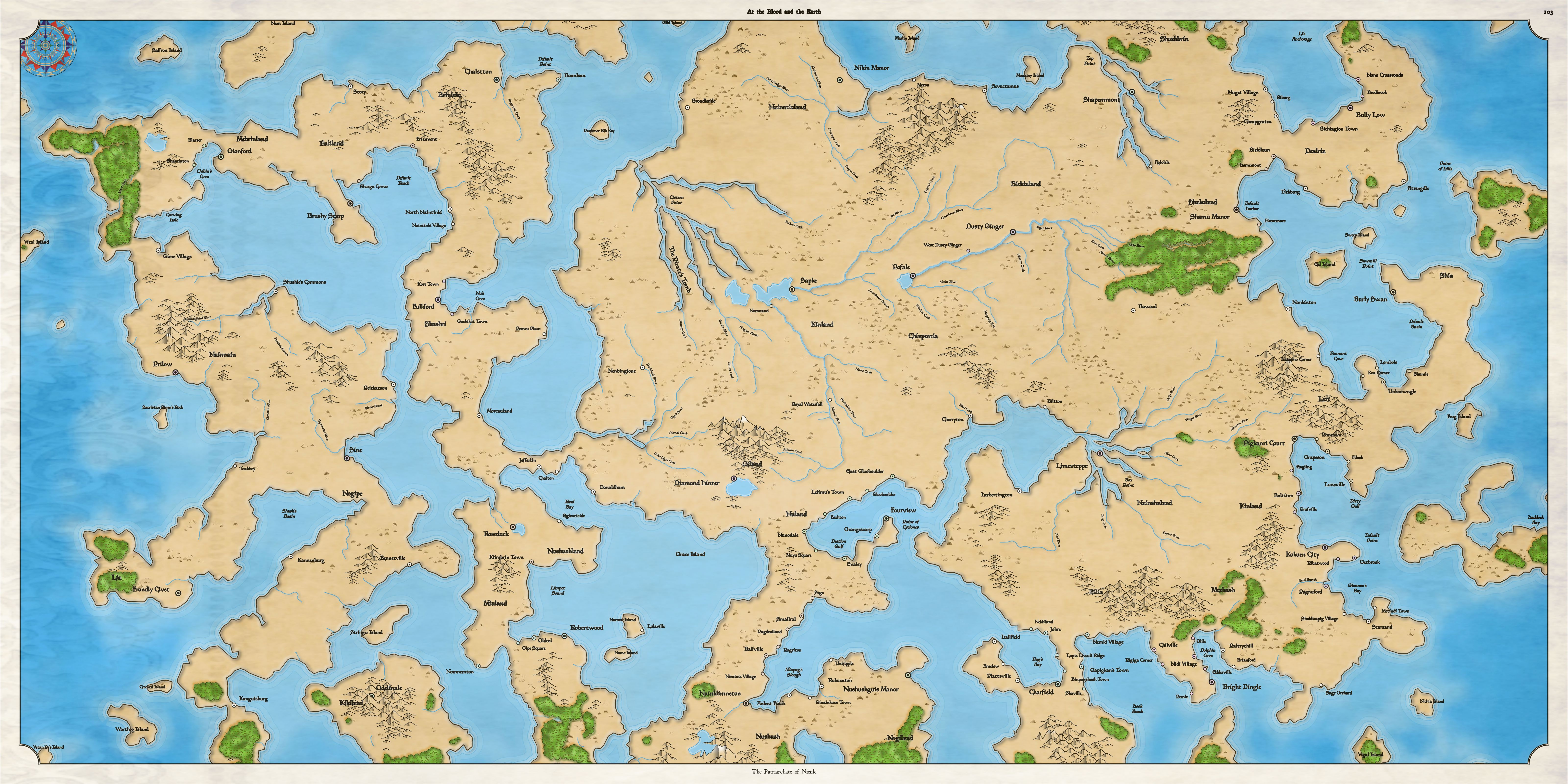
I'm generating these maps using the same procedural generation for the region sized maps. The map above has a pretty reasonable continent shape, and some interesting outlying islands. However, that's mostly luck. Here's another map:

Here's another example, that's somewhere between the other two maps. It's not entirely realistic, but it might be interesting for a fantasy setting:
The majority of fantasy world maps I see depict either a large, island continent (with small islands around it), such as this map of Andelen:

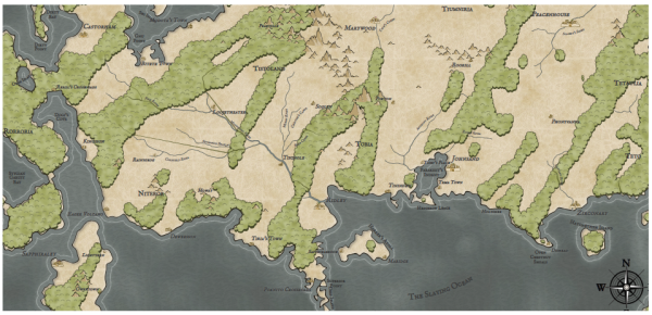
Or an “arm" of a continent, as in this map of Angorun:

First, let me see about generating “island" continents. As it turns out, DA already has a function that generates a large central island on a map, and it's aware of the map size as well, so it should work to create the main continent shape. Some noise and secondary islands should take care of the rest.


Here's the same border control with more reasonable perturbation:

You can see that the east and west ends of the map remain ocean. (This map has a larger view to click through.) This means the map could show an entire world (and wrap from right to left) or if a portion of a world, could be connected to another map that also has ocean along the appropriate edge.
The keen-eyed who clicked through on the previous map will notice that the ocean and land patterns stop halfway across the map. Previously I've only had 1x1 maps, and the ocean and land patterns were sized to fit on those maps. With bigger maps I have to manually tile the patterns across the map, so I added that. (SVG has a way to tile a pattern, but it has a bug in Chrome so I can't use it.) This is a nice feature, because I can now use smaller land and ocean patterns and they'll tile automatically. Not sure why I didn't think to implement this previously!
Now that island continents are working okay, let me move on to implementing “arm" continents -- maps where the continent comes into the map from the edge.

The easiest way to ensure this sort of off-map connection is to set the sea level low during generation. This increases the land area depicted on the map, which increases the chance that there will be a large land mass, and increases the chance that there will be land (and not sea) on the edges of the map.


The keen-eyed reader might have noticed the odd, stripey forest shapes on many of the continent-sized maps. Next time I'll start tackling some problems in the wind and biome models that cause that problem.
No comments:
Post a Comment
Note: Only a member of this blog may post a comment.